Pax Nortona – A Blog by Joel Sax
From the Land of the Lost Blunderbuss
Month: October 2007
Draft Gore
Posted on October 15, 2007 in Campaign 2008
“We face a true planetary emergency. The climate crisis is not a political issue, it is a moral and spiritual challenge to all of humanity. It is also our greatest opportunity to lift global consciousness to a higher level.” — Al Gore
 If last Friday’s announcement of President Al Gore’s winning of the Nobel Peace Prize excited you and you want to give him at shot at reelection, sign this petition.
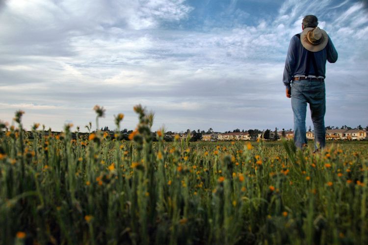
Red Canyon and Bryce
Posted on October 14, 2007 in Hiking Photos Vacation Fall 2007

You come to Red Canyon before you come to Bryce and you wonder if the park entrance sign has been misplaced. This piece of the Pink Cliffs lies inside the boundaries of the Dixie National Forest, about ten miles from the fabled Bryce Canyon National Park. The picture above comes from this piece of government-controlled real estate and the picture below from Bryce.
You can read about a hike in Red Canyon and another in Bryce, both written by me.

Here is the Dixie National Forest album and here is the Bryce National Park album in my gallery. WILL SOMEONE GO OVER THERE AND MAKE A COMMENT? Damn.
Click on more to see important notes.
Broken Buddha
Posted on October 13, 2007 in DBSA Support Groups and Conferences Myths & Mysticism
 The speaker, a well-respected (and fortunately good-humored) San Diego County psychotherapist was giving an example of how our perceptions may shape our reaction to a piece of reality. “Let’s say, I take a statue of the Buddha and smash it on the ground. Now if you’re a Christian, it probably would not bother you. But if you were a Buddhist you –”
“– might feel joy because when you met the Buddha on the road you killed him?”
Sneaking Off
Posted on October 12, 2007 in Photography Site News
I’m back to travelling: I’m off to a DBSA conference until Saturday night. Not going very far.
In the meantime, please visit my gallery and check out the latest photos in my Arizona and Utah albums.
I’d like to explain why I insist on photo comments in the gallery and why I insist on registration. First, I like to see how you react to individual photos. The best place to make the link is at the gallery. Second, if I allow anonymous comments, I will be spammed out. So take the time to register or to retrieve your password. Let me know what you like.
Thanks for your insights.
Friday Xenartha Blogging – Peter the Anteater
Posted on October 12, 2007 in Xenartha
While working as mascot for UCI:
This is Your Body on Fast Food
Posted on October 10, 2007 in Sugar and Fat
 I don’t watch television except while I am on vacation, so the ideas and attitudes which get disseminated through commercials doesn’t get to me much. During this trip, I observed an interesting trend when it came to food commercials. With the exception of the campaign being waged by Quizno’s (promoting low fat sandwiches), there was a sharp discrepancy: people who ate fattening foods were never portrayed as fat.
You hear it all the time about the models with thin figures that make those of us who don’t have such bodily forms feel ashamed of ourselves when the product is clothing, but nothing about those who gorge themselves on trans-fats saturated burgers, pizzas, and the like apparently without ever putting on a pound. In the former case, we are told that the portrayals promote the comparitively rare disease of anorexia (hard enough, however, on those who have it) but we never hear the same people complain about how the food commercials promote the much more common and dangerous condition of obesity.
To put it succinctly: the bodies shown in most food commercials are those of actors or actresses who spend their time exercising, dieting, and generally keeping their bodies from becoming bloated. They are not realistic consumers of the product. Perhaps some truth in advertising should be demanded here? “This is your body on corn syrup.”
Damn, I just ate half a bag of chocolate. I’m one to talk.
[tags]body image, obesity, fat, fast food[/tags]
Glen Canyon (Marble Canyon)
Posted on October 10, 2007 in Photos Vacation Fall 2007

Highway 89 travels like it is avoiding the [[Vermillion Cliffs]] at all costs before making a sharp left across some alluvial fans and stabbing across the Colorado River via the [[Navajo Bridge]]. Today there are two Navajo Bridges: a new one which can handle the heavy trucks of today and an older one — the original — which now carries only walkers. both mark the only gateway within Arizona to the region known as the Strip.
We stopped on the “mainland” side of the bridges to walk across and read the signs placed by the NPS. I found it a little unnerving to stop at the steel plates that join the two halves of the old Navajo Bridge or to look over the side at the great, green, greasy-looking Colorado River whose banks are quite barren of fever trees. We spent but little time there, mostly coaxing a ranger to give us a brochure about Lee’s Ferry — just upriver — so we could hike the River Trail and explore the ruins of a small town founded by one of the perpetrators of the [[Mountain Meadows Massacre]].
For whatever reason, the area is under the jurisdiction of Glen Canyon National Recreation Area rather than Grand Canyon National Park which begins just south of the new Navajo Bridge. Signs along the short access road explain the geology of the Vermillion Cliffs and point out odd features such as chunks of [[Navajo Sandstone]] that have rolled off onto pedestals of the [[Moenkopi Formation]].

We performed all our obligations by stopping at turnouts and hiking the River Trail up to the last set of ruins. There wasn’t much difference between these nineteenth century relics and [[Anasazi]] pueblos — they were made of the same stone, using the same mortar. Pieces of a steamboat poked up in the water and a piece of cable from the original operation lay on a beach covered with desert pavement. When we were finished, we watched some packers set up their boats for a raft expedition down river. The concrete ramp and that alone may have been the reason for the separation of this area from the national park. Or maybe it was just too far from the main area of operations.

Here is the album in my gallery (10 pics).
Click on more to see important notes.
Grand Canyon – South Rim
Posted on October 9, 2007 in Photos Vacation Fall 2007

I am not [[Ansel Adams]] and I make every effort not to frame my photos as he might have done. For every scene, I endeavor to create a unique take. And yet there are places on this planet where my camera turns out material like that being engendered by the legions of shutters being pointed by those beside me, as engendered by the legions who came before me, and by those who are yet to come.
Photographing the Grand Canyon and maintaining one’s peculiar artistic vision sucks. Thank the Universe for the condors, the clouds, the split-twig figurines at the Tusayan Museum, and for the junipers beside the rim trail.

The canyon was once a wondrous discovery for Pedro de Tovar who came on orders of [[Francisco_Vásquez_de_Coronado|Vasquez-Coronado]] and, having no camera, found himself unable to relay the vibrant magnitude of the gorge. Somewhere near Desert View, he and his men scrambled into the abyss, aiming for the river they saw in the distance. Palisade after palisade thwarted their desire to drink of the muddy Colorado. Perhaps Tovar was a lucky man because he did not have to bring home images that looked pretty much like all the other images that people have taken over the years of what one writer described as “an erosion-control engineer’s nightmare”. All that pinkness and yellowness squashed together in layers that Fundamentalists have tried hard to read as incidents in the course of The Flood despite the reality that the canyon is an amazing indictment against Creationism. Yet its magnitude overwhelms its details, so the story is not heard. We see it as a backdrop, a canvas without a voice, the epitome of what [[Alfred_Stieglitz|Stieglitz]] held to be the accessibility of all Nature to the amateur photographer: you see one picture of the Grand Canyon from Grandview Point, you’ve seen them all. Or just about.
We started our day at Mather Point where we made our acquaintance with the condors who were a sensation two days ago when we posted them to our blogs. (See Lynn here.) We then rode the bus designed for the hordes to the El Tovar, had a fine lunch with a mediocre view, and then rode back to the truck. Because the Red Line was down for the day, we drove out to Hermit’s Rest, gave a ride to a stranded girl back to the Village, and then went out by way of the Tusayan Museum (where I scryed the famous stick figurines*) and Desert View.
In other words, we did our tourist duties.
It was at Desert View, while others were trying to capture the colors, that I aimed my camera into the sun and the mist:

Was this more like Adams or Stieglitz? Or could I claim it as distinctly my own?
Here is the album in my gallery (20+ pics).
*Check out the Quicktime plug-in of the split-twig figurines on this page.
Click on more to see important notes.
Feeding the Antipsychiatry Frenzy
Posted on October 9, 2007 in Bipolar Disorder Crosstalk Psycho-bunk
Check out this article about Rebecca Riley, a four-year old who was found dead of prescription medication overdose:
Such a joy to behold our nation’s lovingkindness babyshakers making headway. And every journalist (cough) netroots blogger who exploits this atrocity (look it up) for their unrelated
healthcarepolitical agenda can cancel her out, ignore the inconvenient truth in evidence, and live with that however the hell you live with that, but you don’t get to choose the facts. Facts? What are facts, really, but just more of the same old same old, garden variety fodder for militant antipsychiatry hippies. Facts, distortions, speculations (sigh), if only there was some way to get to the bottom of what went on in that child’sbrainhouse.
 Yes, I have heard the “bipolar diagnoses are a fad” refrain on blogs and in the media. Here we have a medium where we can put out the stories that the slanted mainstream ignores and what do we do? Echo the S-ciento-logists and others who don’t have a freaking clue about what mental illness is all about. “It’s really a flaw in character,” we hear over and over again. “Or your engrams are out of whack.” While I believed that, I put myself through a hell resplendent in its purple miseries and self-recriminations. How much easier life has been since I put the focus on managing an illness instead of seeking an evil that might be lurking in me.
Doctors used to ignore bipolar symptoms in the young. It was just their upbringing or maybe a “bad seed”. The guardians of the old beliefs are out to suppress any possibility of innocence due to disease. I believe I hear the voice of the Grand Inquisitor promising to hand out bread if we will forgo the comfort that medication brings. “We must make them rely on us,” I can hear it being said. “Medication is dangerous because it frees them.”
That Kindly Trip
Posted on October 9, 2007 in Driving
If you ever plan to motor west,
Travel my way take, the highway that’s the best.
Get your kicks on Route sixty-six.
 Just found out, as a consequence of my trip, that [[Route 66]] — which wends its way through my hometown of [[San_Bernardino%2C_California|San Bernardino]] — is considered to be an endangered place both nationally and internationally. Petrified Forest NP proclaims itself as the only place where the highway is preserved by the National Park Service. Personally, I had a hard time finding it given that it was buried beneath Interstate 40. Still, NPS has an old, rusting hulk out to memorialize the famous highway.
I’ve tried to explain some of the magic of the route to my wife as we drove across California and Arizona, but she didn’t get the romance much except to gawk at the teepees in Holbrook, Arizona. (San Bernardino also has a set.) Her previous experience of Route 66 was a rough segment of road near Blue Cut in the [[Cajon Pass]]. The potholes demonstrated an appetite for wheel alignments and axles. There wasn’t much to see except passing trains and the cut itself which most people don’t know refers to the basalt that has been dragged to the place by the [[San Andreas Fault]].
Back home and in the post-vacation doldrums, I think I could stand more kicks from Route 66. Motion puts my life in balance.
NPS Corridor Preservation Program
Raise your hand if you have driven/ridden on any part of Route 66. Tell us what you saw.
Petrified Forest
Posted on October 9, 2007 in Photos Vacation Fall 2007

Our stop at Walnut Canyon National Monument was brief. We walked the Rim Trail where I spied a fine patch of paintbrush. We reserved the day for Petrified Forest National Park but a pack of thickening [[Cumulus_cloud|cumuli]] brought the makings of a storm.
We began our visit by driving past our turnoff and heading about eighteen miles towards the town of Snowflake, high on the plains of eastern Arizona. When the park road did not materialize, I pulled out a map, realized my error, and reversed our course until we found the large petrified wood yard that had distracted me from seeing the brown sign pointing to the park. The entrance was flanked by a pair of tacky souvenir stores and “museums” that we paid the briefest of visits as the first drops of rain came down. I announced to Lynn that we were abandoning our plans to walk the Long Logs and Agate House trails — I wasn’t going to get caught in the downpour which actually did come later.
The park describes itself as two parks: the fossilized trees in the south and the [[Painted_Desert%2C_Arizona|Painted Desert]] in the north. Or to put it another way: heaps of colorful, crystalline stone versus vivid mudpiles. I got down on my hands and knees to enjoy the silicates, lying on my side to get the best closeups. The NPS thoughtfully provided paved paths through Giant Logs and the Crystal Forest, so I did not muddy myself.
The insensitivity of tourists never ceases to amaze me. At Agate Bridge, a troupe of Australians ignored warning signs and went for a gander on the wet mud, leaving their footprints behind. I nearly remarked that it was a lot easier to disobey the rules when it is not your own country’s heritage being trashed but my mood stabilizers were working and I held my tongue.
Far more tolerable were the Filipinos who we met at Newspaper Rock. I set up my telephoto lens so I could get decent views of the petroglyphs from which the Park Service kept us by means of steep cliffs. I helped them find the chippings and let them look through my camera so they could find the hard to see outline of [[Kokopelli]]. We kept following them and they kept following us for the rest of the afternoon, exchanging quips at every stop and smiling broadly.

Here is the album in my gallery (30 pics).
Click on more to see important notes.
Wupatki
Posted on October 8, 2007 in Photos Vacation Fall 2007

The speck attached itself to the ramparts of the red sandstone pueblo and stayed there. I stood in the parking lot, waiting for the good picture moment, when the cerulean dot would move behind the ruin. But it darted about, an icefly intent on destroying the mood of desolation and isolation that I was trying to convey. Ruins must do that. It is not proper to have someone hanging from them or otherwise obstructing the view as this senior citizen insisted on doing. She was as in my face as a frat boy on Spring Break. Had she drunk deep of brewed spirits and burped loudly, I don’t think she would have annoyed me more.
In the end I had to wait her out. I got the shot and then put up with a brash fellow from who knows where with a butt that waggled and begged to fill my frame. He moved only when his wife climbed down from the ruin and discussed the image he’d just taken. I photographed his white and black-striped butt as possible future revenge.
I don’t know why they’ve never combined Wupatki National Monument with Sunset Crater as a big national park devoted to the impact of geology on human society. As laid out since the 1950s, the two government tracts lie within nineteen miles of each other, separated by empty juniper forests and sage prairie.
We roamed all the “name” ruins, me trying to find the eye I thought I had lost with the death of my old camera and Lynn patiently coming along. She read every word of the trail guide to the main ruin as I fiddled with angles and cursed the midday light that faded the intense red of the rocks to a fizzled bloody pink. It wasn’t until we got to the third pullover of the day — at the fortification called The Citadel that I began getting a feel for the land. Most extraordinarilly, I realized that we were surrounded by miles and miles of open prairie with not a tree in sight. The sky, too, held nothing other than the blue of filtered space. I captured this landscape from the rim of the butte and called it the best and truest of the day.

Here is the album in my gallery (9 pics).
Click on more to see important notes.